
WINTER RIVER - TRACADIE BAY WATERSHED ASSOCIATION
Supporting The Watershed,
So It Can Support You


Field Work


Stream Assessments
Before we can do any work in the streams, we need to know what work needs to be done.
Stream assessments involve the crew walking along streams to determine how functional a stream is and what may need to be done throughout the summer to maintain stream health.
Some examples of what we assess for are:
-
bank integrity
-
wildlife present
-
flow
-
beaver activity


Stream Clearing
A healthy stream contains plenty of woody debris to provide shelter to and feed aquatic species. Having areas with reduced flow is important to provide fish with a resting space and feeding ground.
While woody debris is a key component to our streams, sometimes debris becomes excessive. Major blockages can prevent weaker swimming fish from reaching their breeding grounds and restrict the return of young fish to their homes. It is on those rare occasions where members of staff go out and notch a small portion of the blockage to open up space for fish passage while retaining the majority of woody debris in the streams.


Tree Planting
Each Spring/Summer our crew devotes their time to planting native trees and shrubs in an effort to restore the nearly destroyed Acadian forest.
We have information on the process we follow for tree planting here.


Garbage Cleanup
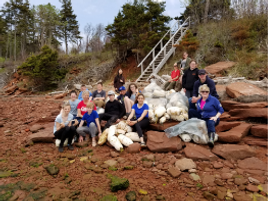
During the field season, our crew goes to areas throughout our watershed to pick up litter and waste to keep these areas clean and healthy. Typically we do two types of cleanups, roadside and shoreline.
.png)
Invasive Species Management
Throughout the field season, our field crew surveys for invasive species around our watershed. When located, the invasive species are marked by GPS, and after ensuring all requirements are met (i.e season, gear, knowledge), we go in and remove the invasive.


The series of pictures above represent the crew removing glossy buckthorn, a process which can be rigorous, either requiring removal of the entire plant, including roots, or a new process we have made use of, covering them with an opaque black bag to prevent any future suckering of the plant.


An important aspect of our work with invasive species is identifying them out in the field while carrying out our regular work. We take many pictures of invasives seen out in the field, and from the pictures and the crew's assessment, we determine the next course of action.
Water Monitoring
Throughout the field season our crew goes out to measure water parameters at springs and streams throughout our watershed. Using a YSI, v-notch weirs and tools to measure height and speed of flow, we are able to closely monitor the health and stability of our local ecosystems.
Crop Mapping
Starting in late July/early August, a couple of our crew members will drive around the watershed visiting every field they can to document the crops grown during that field season.
Documenting this allows us to monitor farming practices in the area to better understand the potential risks to our watershed and what changes could be made to reduce the impact of farming on our watershed.
The information gathered from these surveys is placed in a document along with all previously recorded crop data for a given field.

